New Milford is a single town in Litchfield County, Connecticut, and a member of the Western Connecticut Planning Region. Unlike many New York places, it does not split into a town and a separate incorporated village. One Town Hall, one Mayor and Town Council, one set of land use commissions, and one Tax Collector cover the whole town, from the downtown village center to Gaylordsville in the northwest corner and Merryall in the northeast. Connecticut has had no county government since 1960, so "Litchfield County" is a place name on a deed, not an office you call. Questions about zoning, permits, assessments, and taxes go to the Town of New Milford.
Town of New Milford. Official site: newmilford.org. Town Hall is published at 10 Main Street, New Milford, CT 06776, main phone (860) 355-6000, with a Spanish-language line at (860) 457-4199. The town lists the Town Clerk at 860-355-6020, the Tax Assessor at 860-355-6070, the Tax Collector at (860) 355-6085, the Building Department at 860-355-6090, and Zoning at 860-355-6095. Hours vary by office, so confirm on the town site before a visit.
Keep the map names straight when you write an offer or a listing brief:
Town of New Milford - the only municipal government here. Summaries describe it as the largest town in Connecticut by area, with Census figures of about 63.7 square miles, roughly 61.6 square miles of land and 2.2 square miles of water.
Downtown New Milford - the main population center in the Housatonic River valley, which the Census Bureau tracks as a census-designated place of about 3.4 square miles. It is a statistical area, not a separate government. Summaries note that Town Hall stands on the former house lot of Roger Sherman, a signer of the Declaration of Independence.
Named sections inside the town. Summaries list Gaylordsville (the northwest corner, along the Housatonic, with its own 06755 ZIP code), Northville (about 4 miles northeast of the town center along US-202), Upper Merryall and Lower Merryall (the northeast corner), plus Chimney Point, Lanesville, Still River, Candlewood Hills, and Sunny Valley. These are sections of one town, not separate municipalities.
ZIP codes are not town lines. Town Hall, the library, and the school district all publish 06776 (New Milford) addresses. Gaylordsville uses 06755. Summaries also note that some homes in Sherman are often considered part of the Gaylordsville community, so name the town on the tax bill, not just the post office or the community name.
The Garay Team is licensed in New York and Connecticut only.
See related inventory and guides: Kent, Washington, Roxbury, Litchfield, Ridgefield, Pawling, Litchfield County, Fairfield County.
Summaries describe the Wawyachtonoc, an Algonquian-speaking people, as the earliest known inhabitants of the area, farming along the Housatonic and its tributary, the Still River. English settlement began in 1707, when John Noble Sr. and his young daughter Sarah Noble arrived. The town was organized after a 1711 petition to the Connecticut General Assembly. The Town Clerk's land records date back to 1712. New Milford stayed part of New Haven County until Litchfield County was formed in 1751.
The village center. The New Milford Center Historic District, listed on the National Register of Historic Places in 1986, takes in streets around the large town green. In the second half of the 1800s, tobacco became the main local crop, and several tobacco warehouses from that era are individually listed on the National Register, including buildings on Wellsville Avenue and Bridge Street.
The railroad town. Summaries state that regular rail service from Bridgeport to New Milford began on February 19, 1840, on the original Housatonic Railroad. The former Housatonic Railroad Station on Railroad Street is listed on the National Register (1984). Passenger trains north of Danbury ended in April 1971. That is history, not current service.
Bridges over the Housatonic. Boardman's Bridge, on Boardman Road over the Housatonic, and the Lover's Leap Bridge, built in 1895, were both listed on the National Register in 1976. The Lover's Leap Bridge has been closed to vehicles since 1977, after a new crossing was built just to the north.
Gaylordsville, Northville, and Merryall. Gaylordsville takes its name from William Gaylord, who built a frame house north of the river straits in 1728. Summaries list the Little Red Schoolhouse (the Gaylord School) and the Merwinsville Hotel (1843) among its historic sites. Northville grew around farms settled in the 1750s, including Hine-Buckingham Farms, listed on the National Register in 2004. The name Merryall dates to 1726, when a group of surveyors gave it to the land, and the Merryall Union Evangelical Society Chapel (1890) is on the National Register.
If a listing references a historic designation, confirm it in state and federal records.
New Milford sits in the Housatonic River valley. Summaries describe the Housatonic, the Still River, and the East Aspetuck River flowing through the town, with the West Aspetuck running through Merryall. Highways and old roads make the neighbors easy to read: US-7 runs south into Brookfield and north into Kent, the Sherman town line forms the western edge of Gaylordsville, US-202 heads northeast into Washington, and Route 67 heads southeast toward Bridgewater and Roxbury.
High ground and named hills. Candlewood Mountain rises south of Gaylordsville and gave its name to Candlewood Lake. Long Mountain marks the eastern side of the Gaylordsville valley, and summaries list Bear Hill at 1,281 feet in Lower Merryall. On hillside lots, ask about driveway grade and ledge before you plan site work.
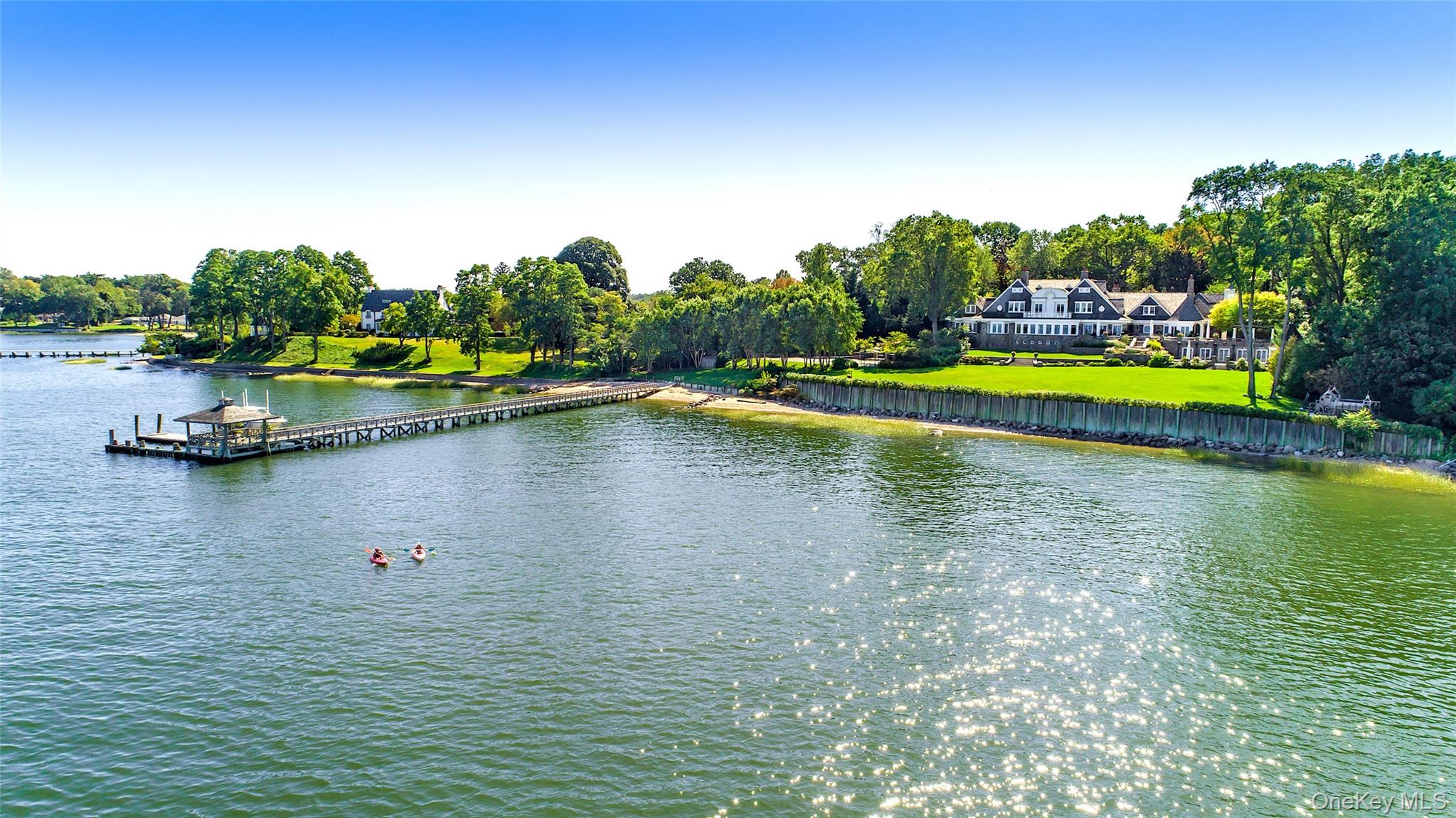
Candlewood Lake. Summaries describe Candlewood Lake as a man-made lake and the largest lake in Connecticut, created between 1926 and 1928 as a pumped storage project and completed on September 29, 1928. The Candlewood Lake Authority lists it at 5,420 acres with about 65 miles of shoreline. Its shoreline municipalities are Brookfield, Danbury, New Fairfield, New Milford, and Sherman. FirstLight Power owns and operates the lake as a hydroelectric facility licensed by the Federal Energy Regulatory Commission, and the large earthen dam and pipeline to the Housatonic sit at the lake's northeastern tip in New Milford.
Lake Lillinonah. Summaries describe Lake Lillinonah as Connecticut's second largest lake, formed in 1955 when the Shepaug Dam impounded the Housatonic and Shepaug Rivers. It borders six towns, including New Milford, and Lovers Leap State Park sits along its northern edge.
We will not publish a median sale price, days-on-market claim, school ranking, or lake premium for New Milford on this page. Use live listings and a dated MLS extract when you need numbers.
The Rocky River Project Boundary. The Candlewood Lake Authority explains that the boundary formerly called the "440' Line" is often misunderstood. It says about 95% of Candlewood waterfront owners own down to the Rocky River Project Boundary but not below it, and that FirstLight owns the land from that boundary to the water. Only a land survey locates it. Your deed will tell you which side you own.
Work below the boundary. According to the Authority, cutting trees, clearing vegetation, building or changing a sea wall or retaining wall, adding a shed, or changing the size or layout of a dock below the boundary all need FirstLight's approval through its permit portal, and then town approval. Ask a seller for any FirstLight permits for the dock, wall, or shoreline work you see.
The 200-foot wetlands zone. The Authority notes that property within 200 feet of Candlewood Lake falls in a regulated inland wetlands zone, where some activities need local permits. In New Milford that means the Inland Wetlands and Watercourses Commission. Check with Zoning as well.
Winter drawdown. The Authority says there is no set schedule for lowering Candlewood Lake, and that levels can change at any point from November 1 to Memorial Day. For winter 2026 to 2027, it posted FirstLight's notice of a deep drawdown starting after November 1, 2026, as weather allows, targeting an elevation of 418 feet against a normal summer range of 427 to 429.5 feet. Owners are urged to pull docks and lifts before ice season. A winter showing may not show June's shoreline.
Swim areas, moorings, and launches. The Authority states that swim areas need a CT DEEP permit, swim platforms are allowed only inside approved swim areas, and unpermitted moorings are not allowed. In New Milford, residents launch through the town: Parks and Recreation sells a resident season pass for Lynn Deming Park, at 134 Candlewood Lake Road North, with a separate boat ramp pass. FirstLight's Dikes Point Recreation Area, on Old Town Park Road in New Milford, is carry-in only for kayaks and canoes, and the Authority says reservations are required.
Association membership, deeded lake rights, and shared docks vary by parcel. Ask for the deed, any association documents, and the survey before you rely on a listing's "lake rights" line.
Roads. Daily access for almost every address is by car. Summaries describe US-7 running as a freeway north from I-84 in Danbury to just south of the New Milford town line, where it rejoins US-202 and continues as a four-lane road into town. In central New Milford, US-202 turns east with CT-67 to cross the Housatonic, and US-7 continues north as a two-lane road through Gaylordsville toward Kent. US-202 continues northeast toward Washington and Litchfield. CT-67 breaks southeast from the town center toward Bridgewater and Roxbury. CT-37 comes in from Sherman, and CT-55 runs from the New York line in Sherman to US-7 in Gaylordsville. The town Public Works Department posts a road list showing which roads are town roads and which are maintained by the Connecticut Department of Transportation. That matters for driveway permits.
Rail honesty (important). There is no Metro-North station in New Milford. The tracks through town carry Housatonic Railroad freight, not passenger trains.
Extension talk is not service. Proposals to extend or electrify the Danbury Branch north to New Milford have come up for years. No extension has been scheduled or funded, so do not price a home on it.
No invented commute minutes. TrainTime, MTA timetables, and the morning you actually travel are the source of truth. We will not invent a door-to-Grand-Central number from a New Milford address, and we will not invent a drive time to Danbury or Brewster.
Local transit. Summaries state that Housatonic Area Regional Transit (HART) runs fixed bus routes in New Milford. Confirm current routes and schedules with HART before you rely on them.
Lovers Leap State Park. CT DEEP lists the park at 178 Still River Drive, New Milford, CT 06776, open daily from 8 a.m. to sunset. DEEP describes 160 acres straddling the Housatonic along the northern edge of Lake Lillinonah, with four miles of trails, river gorge views, factory ruins, and the 1895 Berlin Iron Bridge. Orientation: CT DEEP - Lovers Leap State Park.
New Milford River Trail. The New Milford River Trail Association reports a completed five-mile section from the Boardman Road entrance of Sega Meadows Park, about 1.5 miles of crushed gravel through the park, then about 3.5 miles on unpaved River Road along the Housatonic to the center of Gaylordsville at Route 7. Parks and Recreation says a parking pass from the Mayor's Office, available to residents of New Milford and bordering towns, is required for the Sega Meadows lots and River Road pull-offs from May through October. Orientation: New Milford River Trail Association.
Housatonic Range Trail. The Connecticut Forest and Park Association lists this blue-blazed, hiking-only trail at 6.2 miles, entirely in New Milford. It runs from Gaylord Road south over Boardman Mountain and Pine Knob to Candlewood Mountain. Orientation: CFPA - Housatonic Range Trail.
Harrybrooke Park. Harrybrooke Park and the Harden House Museum, a nonprofit at 100 Still River Drive, describe grounds open from sunup to sundown and a no-dogs rule. Its site also mentions reopening updates, so check status first. Orientation: harrybrookepark.org.
Town recreation. The Parks and Recreation Department is based at the John Pettibone Community Center, 2 Pickett District Road, phone 860-355-6050. For 2026 it listed a $65 resident season vehicle pass for Lynn Deming Park and Addis Park, requiring two proofs of residency. Fees change each season.
New Milford Public Library is at 24 Main Street, New Milford, CT 06776, phone 860-355-1191, one block north of Town Hall, with parking on the street and behind the building. The library lists hours of Monday and Friday 10 a.m. to 5 p.m., Tuesday through Thursday 10 a.m. to 8 p.m., Saturday 9 a.m. to 5 p.m., and closed Sunday. Orientation: newmilfordlibrary.org.
The village green and Main Street. The library's directions send visitors onto the Village Green, with the library one block north of Town Hall, inside the historic district. The town's site points to a Saturday farmers market and seasonal events.
When we show homes in New Milford, stops we actually use include Town Hall on Main Street, the library, the Pettibone Community Center, Sega Meadows, and Lynn Deming Park. Hours change, so check them the morning of a showing.
New Milford Public Schools publishes its district office at 25 Sunny Valley Road, Suite A, New Milford, CT 06776, phone 860-355-8406, at newmilfordps.org. Summaries place both the downtown area and Gaylordsville in the New Milford school district. Confirm enrollment and assignment for a specific address directly with the district. This page does not rank schools or describe who lives here.
Start with the parcel record. New Milford's Assessor links an online property database run by Vision Government Solutions at gis.vgsi.com/newmilfordct, searchable by location, owner name, or list number, plus street and sales listings. The town's GIS maps are at newmilfordct.mapgeo.io. Deeds, mortgages, liens, and survey maps are in the Town Clerk's land records, searchable online through the town's land records portal. The Clerk also offers a free Property Check service to help owners guard against property and mortgage fraud.
Revaluation and assessments. Connecticut requires a revaluation at least every five years. The Vision site says New Milford's 2025 revaluation set market values as of October 1, 2025, that notices of assessment change were mailed November 7, 2025, and that posted assessed values do not reflect exemptions.
Taxes. The Tax Collector bills real estate in two installments, due July 1 and January 1. The town's July 2026 notice set August 3, 2026, as the no-interest deadline for that installment. Interest runs at 1.5% per month from the original due date under state law, with a $2 minimum. Bills are posted at mytaxbill.net/newmilford. Sewer charges are paid separately to the Sewer Commission.
Homestead exemption. The Assessor says New Milford adopted a homestead ordinance under state law. It equals 10% of the assessed value of the primary lot and dwelling for an owner who holds title on October 1, lives there as a permanent Connecticut and New Milford resident, and claims no residency-based benefit elsewhere. The application is due by the following December 31. A second-home buyer should not count on it.
Water, sewer, well, and septic. Aquarion Water Company's New Milford Regional System reports serving customers in New Milford and Brookfield from well fields, including Indian Field and Peagler Hill in New Milford. The Sewer Commission, acting as the Water Pollution Control Authority at 123 West Street, (860) 355-1049, says the village center and many surrounding neighborhoods are in the sewer district, and it can levy benefit assessments. Parcels outside the water system and sewer district may use a private well and septic system. Since February 1, 2022, New Milford's health functions have been part of the Housatonic Valley Health District, which handles private well permits and septic plan review and permits. Ask HVHD for septic records, ask the WPCA about sewer status, and order inspections that fit the property.
Permits and land use. The Building Department reviews plans under the Connecticut State Building Code, collects sign-offs from other agencies, and issues the Certificate of Occupancy after a final inspection. Permits are filed through the town's online permitting portal. Zoning posts its regulations and maps, and Planning posts the 2021 to 2031 Plan of Conservation and Development. Driveway and right-of-way permits for town roads go through Public Works at 6 Young's Field Road, 860-355-6040. Ask for open permits and certificates of occupancy before you list or close.
Flood zones. Check the FEMA flood map for the parcel at the FEMA Flood Map Service Center, and ask for an insurance quote early, especially near the Housatonic, the Still River, the Aspetuck rivers, and the lakes. State wetland and watercourse programs are run by CT DEEP.
Closing items. Ask for current tax receipts, sewer account status where the parcel is connected, open permit status, any FirstLight shoreline permits, and any lake or road association documents.
Sellers. Accurate place language helps. Say "New Milford" with the section name, such as Gaylordsville, Northville, or Merryall, describe lake access exactly as the deed and survey allow, and do not imply a train station in town.
There is no official primary-versus-second-home percentage for New Milford, and we will not invent one. Our second homes guide covers that planning conversation more broadly.
None of these "wins." They answer different search patterns.
Kent - the town to the north on US-7, farther up the Housatonic valley.
Washington - northeast on US-202, often compared when buyers widen the search into the Litchfield Hills.
Roxbury - southeast on Route 67, another Litchfield County town that touches Lake Lillinonah.
Ridgefield - a Fairfield County town south of Danbury, for buyers weighing Litchfield and Fairfield County addresses.
Pawling - across the New York line, for buyers comparing Connecticut and Dutchess County homes and Harlem Line access.
Litchfield County and Fairfield County - county guides when the search is broader than one town.
Gaylordsville, Northville, Merryall, Candlewood Hills - not separate town pages. They are sections of the Town of New Milford. Say the section name and New Milford plainly.
Is New Milford a town or a village?
It is one town, governed by a Mayor and Town Council from Town Hall at 10 Main Street. The downtown village center and sections such as Gaylordsville and Northville are part of that town, not separate governments.
Is there a train station in New Milford?
No. Metro-North's Danbury Branch ends at Danbury station, and some riders use Harlem Line stations across the state line in Putnam County, New York. Proposals to extend service to New Milford have not been funded. We will not invent a commute time.
Do I own down to the water on Candlewood Lake?
Usually not. The Candlewood Lake Authority says most waterfront owners own down to the Rocky River Project Boundary, and FirstLight owns the land below it. Only a survey and your deed answer this for a specific lot.
Is a New Milford home on public water and sewer?
It depends on the parcel. Aquarion serves customers in New Milford, the sewer district covers the village center and many nearby neighborhoods, and other homes may use a well and septic. Confirm with Aquarion, the WPCA, and the Housatonic Valley Health District.
Can The Garay Team help in New Milford?
Yes, for Connecticut licensed brokerage in Litchfield County. Contact [email protected], use our contact page, or start with selling with The Garay Team when you need a listing plan.

Office 17 Collegeview Ave Poughkeepsie, NY 12603
Office 17 Collegeview Ave Poughkeepsie, NY 12603