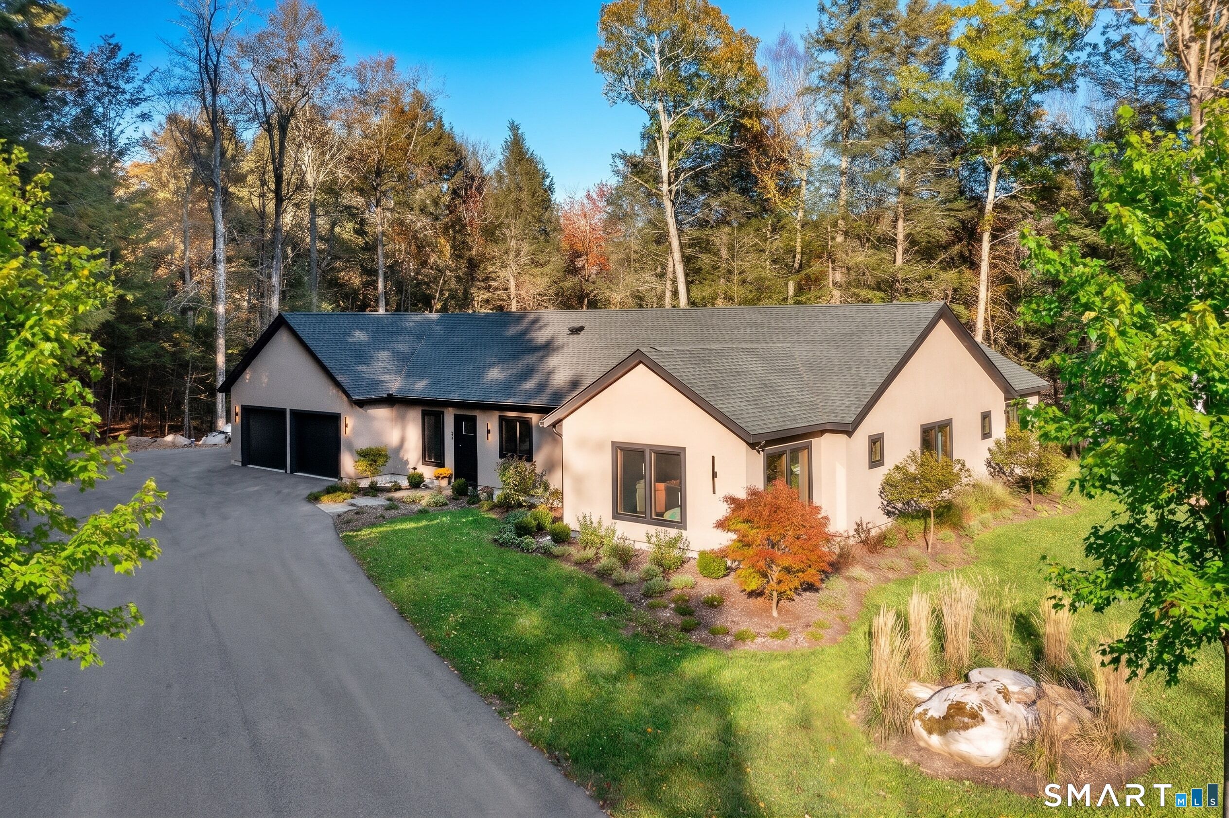
Welcome to Litchfield, Connecticut
One town in the Litchfield Hills, with two boroughs, three villages, the historic Green, and the north shore of Bantam Lake
Litchfield is a town in Litchfield County, Connecticut, and a member of the Northwest Hills Planning Region. It was the county seat when Connecticut still had county government, which ended in 1960, so today "Litchfield County" is a place name on a deed, not an office you call. The town covers about 57 square miles, according to its Land Use Department and Census figures. What makes Litchfield different from most Connecticut towns is that two incorporated boroughs sit inside it, each with its own officers, its own tax, and its own rules. Getting that layering right is the first job in any Litchfield purchase or listing.
Town of Litchfield. Official site: townoflitchfieldct.gov. Town Hall is published at 74 West Street, Litchfield, CT 06759, with the Town Clerk at (860) 567-7561, the First Selectman at (860) 567-7550, the Assessor at (860) 567-7559, and the Tax Collector at (860) 567-7557. The Building Department, Land Use, the Fire Marshal, and Park and Recreation work from the Town Hall Annex at 80 Doyle Road in Bantam, with Building at (860) 567-7567 and Land Use at (860) 567-7565. The town lists Town Hall hours as Monday through Thursday 8:30 a.m. to 4:30 p.m. and Friday 8:30 a.m. to 1:30 p.m. Confirm before a visit.
Keep the map names straight when you write an offer or a listing brief:
Town of Litchfield - the municipality that covers everything on this page. It runs on a Town Meeting form of government with an elected Board of Selectmen led by a First Selectman.
Borough of Litchfield - the village center around the Litchfield Green, about 1.4 square miles by Census figures. The General Assembly incorporated it as a village in May 1818, and it was rechartered as a borough on March 21, 1879. It is governed by a Warden and Board of Burgesses, separate from the town's Board of Selectmen, and it has its own Historic District Commission.
Borough of Bantam - a separate borough, about 1.0 square mile, on US-202 west of the center, north of Bantam Lake. Its own site describes it as a borough since 1915, with a Warden and Burgesses who meet at Bantam Borough Hall, 890 Bantam Road, plus its own Planning and Zoning Commission and Zoning Board of Appeals. Bantam uses the 06750 ZIP code.
Northfield, Milton, and East Litchfield - unincorporated villages, not separate governments. Northfield sits in the southeastern corner of town and has its own ZIP code, 06778, though summaries note it has no operating post office. Milton is in the northwestern part of town. East Litchfield sits east of the center along Route 118, near the Naugatuck River.
ZIP codes are not town lines. Town Hall uses 06759, Bantam uses 06750, and Northfield uses 06778, but all three are the Town of Litchfield. Two of them also sit under a borough. Name the town, and the borough when there is one, as the tax bill does.
The Garay Team is licensed in New York and Connecticut only.
See related inventory and guides: Washington, New Milford, Roxbury, Kent, Sharon, Salisbury, Litchfield County.
History you can still see on the map
Settlement and the county seat. Summaries describe the area as originally called Bantam township, incorporated in 1719 and named for Lichfield in England. The Green was laid out in 1720 as common pasture and the site of the first meetinghouse. In 1751 Litchfield became the seat of the newly formed Litchfield County, and the county courthouse went up on the Green.
The Revolution. The town served as a supply depot for the Continental Army. In July 1776 the lead statue of King George III pulled down on New York City's Bowling Green was brought to Litchfield, where it was melted into bullets at the home of Oliver Wolcott, a signer of the Declaration of Independence. The borough notes that George Washington stayed at the Sheldon Tavern, which still stands on North Street.
Law school and academy. In 1784 Tapping Reeve formally opened the Litchfield Law School on South Street, widely described as the first law school in the United States. In 1792 Sarah Pierce founded the Litchfield Female Academy on North Street. The Tapping Reeve House and Law School is on the National Register and is now run by the Litchfield Historical Society.
The first historic district in Connecticut. According to the Borough of Litchfield, the borough's Warden and Burgesses moved to restrict new construction after the 1939 demolition of the Phelps Tavern. In 1959 a special act of the General Assembly designated the entire borough the "Old and Historic Litchfield Historic District," the first such district in the state. In 1968 the central part of the borough was designated a National Historic Landmark, the Litchfield Historic District. In 1978 the entire borough, about 840 acres, was listed on the National Register of Historic Places.
Milton and Northfield. The Milton Center Historic District, on the National Register, covers the 19th century village center of Milton along Milton Road. Summaries say Milton was settled around 1740, was first known as West Farms, and had its first church built in 1791. Its mill industries ran on the branches of the Shepaug River. In Northfield, the Northfield Knife Company operated from 1858 to 1926, and the foundations of the factory by Knife Shop Dam were listed on the National Register in 1997.
Rail history, not rail service. Summaries state that the Shepaug Valley Railroad opened a Litchfield terminal in 1872, with passenger service ending in 1930 and freight in 1948. An East Litchfield depot on the Naugatuck line opened in 1849. None of this is current service.
If a listing references a historic designation, confirm it in state and federal records and with the commission that has jurisdiction.
Living inside a historic district
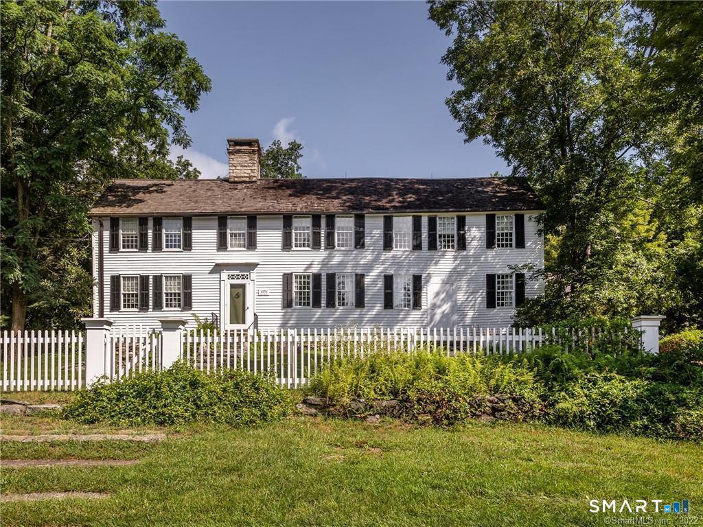
Borough of Litchfield. The borough explains that, because of the historic district designation, exterior changes to structures that are visible from a public way must be reviewed and approved by the Historic District Commission. The stated aim is to prevent changes that would be "incongruous with the District's historic and architectural character." The borough posts its regulations and forms. Ask about windows, roofing, siding, fences, signs, additions, and paint plans before you count on them.
Borough rules owners notice. The borough's own notices say commercial signs are not permitted in the borough and should not be placed in lawns. They also remind owners that the borough code requires them to clear snow, sleet, and ice from adjacent sidewalks on a set timeline, and that the borough may clear it and bill the owner with a surcharge if they do not.
Milton. The town also has a Milton Historic District Commission, which meets at the Trinity Church Parish House, 536 Milton Road. Summaries note that the Milton National Register district sits inside a larger locally designated district. If a Milton address is in that local district, ask the commission what needs review before you plan exterior work.
Watch for changes. A town committee has studied whether to consolidate the Borough of Litchfield and its Historic District Commission into the town. Check the current status rather than assuming either way.
Bantam Lake, the Bantam River, and White Memorial
Bantam Lake. The town, the White Memorial Foundation, and state summaries all describe Bantam Lake as the largest natural lake in Connecticut. It sits in the towns of Litchfield and Morris. The Bantam River enters and leaves the lake on its north shore, and summaries describe it draining parts of Goshen, Litchfield, Morris, and Washington before it empties into the Shepaug River. The town lists a Bantam Lake Authority among its boards.
White Memorial. The White Memorial Foundation was created in 1913 by Alain C. White and his sister May W. White, and the Foundation says it now covers about 4,000 acres of forest, fields, and wetlands in Litchfield and Morris. The Foundation says the Whites set out to preserve the land around Bantam Lake and acquired about 60% of its shoreline. Its trails are open year-round without charge, including the Little Pond "Boardwalk" Trail. The White Memorial Conservation Center nature museum is at 80 Whitehall Road, about two miles west of the center off US-202, phone (860) 567-0857. Orientation: whitememorialcc.org.
Boating. White Memorial runs the Point Folly Marina and Boat Launch at 123 North Shore Road, with moorings and a small number of slips rented by the season and a paid public launch. The Foundation states that motor boats are allowed on Bantam Lake, but no internal combustion engines are allowed on the Bantam River. Canoes and kayaks can reach the river at the Whites Woods Road bridge.
Beaches. The Litchfield Town Beach, at 244 North Shore Road, is behind a gate that opens with a key fob. Park and Recreation sells an annual resident parking and use permit, and the fob is issued in person at 80 Doyle Road with proof of residency. Sandy Beach, on East Shore Road in Morris, is run by the Sandy Beach Commission under a lease among Litchfield, Morris, and White Memorial, and season passes are sold at the beach and at both town halls. Fees and rules change each season, so check before you rely on them.
What to ask on a lake property. Shoreline rights, docks, moorings, and associations vary by parcel. Ask for the deed, survey, and any association documents before you rely on a "lake rights" line. Work in or near wetlands and watercourses is regulated by the town's Inland Wetlands Commission, so ask Land Use before you budget for a new dock, wall, or clearing.
Getting here
Roads. Daily access is by car. Summaries describe US-202 as the main east-west road, linking Bantam and the Litchfield Green to Torrington in one direction and to New Milford, through Washington, in the other. CT-63 runs north-south through the Green, north toward Goshen and south through Morris toward Watertown. CT-118 starts at the Green and runs east through East Litchfield, crossing the Naugatuck River into Harwinton, where it meets the Route 8 expressway at exit 46. CT-254 runs from the borough southeast through Northfield toward Thomaston. CT-209, Bantam Lake Road, follows the lake's west shore from Morris to US-202 in Bantam. Parts of Route 118 and Route 254 are state scenic roads. Driveway permits go through Public Works, (860) 567-7575.
Rail honesty (important). There is no passenger rail station in Litchfield, and no Metro-North service in town. Metro-North terminals that riders in northwestern Connecticut look at include:
- Waterbury, the northern end of the Waterbury Branch, which runs to Bridgeport. CTDOT and MTA announced that buses replace Waterbury Branch trains from July 20, 2026, through May 31, 2027, during station work. Orientation: mta.info Waterbury Branch.
- Wassaic, the northern end of the Harlem Line, in the town of Amenia, New York.
No invented commute minutes. TrainTime, MTA and CTDOT notices, and the morning you actually travel are the source of truth. We will not invent a door-to-Grand-Central number or a drive time to a station from a Litchfield address.
Local transit. The Northwestern Connecticut Transit District runs local service centered on Torrington and Winsted. Summaries report that its Litchfield route ended in 2023, so confirm current service directly with the district before you rely on it.
Parks, trails, and open space
Topsmead State Forest. CT DEEP lists Topsmead on Buell Road, Litchfield, CT 06759, open daily from 8 a.m. to sunset, phone (860) 567-5694. It was the summer estate of Edith Morton Chase, who left it to the people of Connecticut on her death in 1972 and asked that it be kept in a state of natural beauty. DEEP describes trails, gardens, bird habitats, and an English Tudor style cottage, which summaries say is on the National Register. Orientation: CT DEEP - Topsmead State Forest.
Mount Tom State Park. DEEP lists the park on Route 202 with a Litchfield address, open daily 8 a.m. to sunset, and summaries place it across the Washington, Litchfield, and Morris town lines. DEEP describes a one-mile trail to a 34-foot stone tower on a summit about 1,325 feet above sea level, plus swimming and picnicking at the pond. DEEP notes that parking is limited and the park closes to more visitors when full. Orientation: CT DEEP - Mount Tom State Park.
Humaston Brook State Park. Summaries describe a day-use park in Northfield around Northfield Pond, known locally as Knife Shop Pond, with hiking and fishing.
Town recreation. Park and Recreation runs programs and facility reservations through its online registration site and works from the Town Hall Annex, (860) 567-7569. The town's pages point to summer Concerts on the Green and the annual Litchfield Hills Road Race.
Library, the Green, and civic stops
Oliver Wolcott Library is at 160 South Street, Litchfield, CT 06759, phone 860-567-8030. It posts current hours and holiday closings on its site: owlibrary.org. In Northfield, the town lists the Gilbert Library as a community library.
Litchfield Historical Society. The Society lists the Litchfield History Museum and its research library at 7 South Street and the Tapping Reeve House and Law School at 82 South Street, with posted museum hours of Wednesday through Sunday, 11 a.m. to 5 p.m. It also sells a walking tour map of the historic district and offers a free digital version. Orientation: litchfieldhistoricalsociety.org.
The Green. The Litchfield Green sits where US-202 and CT-63 meet. Summaries note that the town formally designated it a park in 1836. The Borough of Litchfield has published a Green Revitalization Plan on its site.
When we show homes in Litchfield, stops we actually use include Town Hall on West Street, the Annex on Doyle Road, the Green, Bantam Borough Hall, and the White Memorial entrance on Whitehall Road. Hours change, so check them the morning of a showing.
Schools, stated plainly
Litchfield is part of Regional School District No. 20, which serves Goshen, Litchfield, Morris, and Warren. The district says voters in the four towns approved merging Litchfield Public Schools and Region 6 in 2022, and the new district opened with the 2024 to 2025 school year. The district office is at 35 Wamogo Road, Litchfield, CT 06759, phone (860) 361-9033, at rsd20.org. It lists Litchfield Center School, Litchfield Intermediate School, Plumb Hill Middle School, and Lakeview High School in Litchfield. Confirm enrollment and assignment for a specific address directly with the district. This page does not rank schools or describe who lives here.
Buying and owning notes
Start with the parcel record. The Assessor's Office keeps records of ownership, lot size, building details, land maps, and gross and net assessments, and the town links a GIS system from its home page. Land records are in the Town Clerk's office. The Clerk says the grantor and grantee indexes are searchable online back to May 24, 1979, that documents can be viewed free with printing fees, and that owners can sign up for a free fraud alert when a document is recorded in their name. Connecticut has no county recording office, so Litchfield records are recorded in Litchfield.
Assessments. The Assessor explains that Connecticut assessments are 70% of market value as of the last revaluation, and that state law requires a revaluation at least every five years. Ask the Assessor which revaluation year applies to a parcel.
Taxes, in layers. The town Tax Collector says real estate and personal property taxes of $100 or more are due in two installments, July 1 and January 1. The Borough of Litchfield and the Borough of Bantam each levy their own tax on top of the town tax for property inside their boundaries. We are not quoting mill rates because the town's and Bantam's posted borough rates did not match when we checked. Get current figures from the Tax Collector and the borough.
Water, sewer, well, and septic. The town's Tax Collector page refers public water questions to Aquarion. The Water Pollution Control Authority runs the treatment plant at 29 Stoddard Road in Bantam, phone (860) 567-7580, and maintains about 27 miles of sewer lines. It has agreements with Torrington for the Route 202 and Hart Drive area and with Thomaston for the Northfield center area. The WPCA notes that, by town ordinance, no building permit is issued for a property with an outstanding sewer balance or lien. Parcels outside these systems may use a private well and septic, permitted by the Torrington Area Health District, 350 Main Street, Suite A, Torrington, (860) 489-0436. TAHD requires a licensed lab test for new wells and an engineer's soil testing and approved design for new septic systems. Ask TAHD for septic and well records, and order inspections that fit the property.
Permits and land use. The Land Use Department regulates zoning, subdivision, wetlands, and aquifer protection. The town posts Zoning Regulations amended effective March 25, 2026, and the 2017 Plan of Conservation and Development, and it issued a request for proposals in 2026 to update that plan. Inside Bantam, the borough's own Planning and Zoning Commission and ZBA apply. The Building Department issues permits through an online system, inspects work, and issues certificates of occupancy. Ask for open permits and certificates of occupancy before you list or close.
Flood zones. Check the FEMA flood map for the parcel at the FEMA Flood Map Service Center and ask for an insurance quote early, especially near Bantam Lake, the Bantam River, the Naugatuck River, and brooks and ponds. State wetland and watercourse programs are run by CT DEEP.
Closing items. Ask for current town and borough tax receipts, WPCA account status where the parcel is on sewer, open permit status, any Historic District Commission approvals for past exterior work, and any lake or road association documents.
Sellers. Accurate place language helps. Say "Litchfield" with the borough or village name, such as the Borough of Litchfield, Bantam, Northfield, Milton, or East Litchfield. Describe lake access exactly as the deed and survey allow, disclose historic district status, and do not imply a train station in town.
There is no official primary versus second home percentage for Litchfield, and we will not invent one. Our second homes guide covers that planning conversation more broadly.
Compare nearby
None of these "wins." They answer different search patterns.
Washington - southwest on US-202 past Mount Tom, often compared when buyers look across the Litchfield Hills.
New Milford - farther southwest at the other end of the US-202 run, in the Housatonic River valley.
Roxbury - another Litchfield County town to the south.
Kent - to the west in the Housatonic valley, on US-7.
Sharon and Salisbury - northwest corner towns along the New York line, for buyers widening the search.
Litchfield County - the county guide when the search is broader than one town.
Bantam, Northfield, Milton, East Litchfield - not separate town pages. They are parts of the Town of Litchfield, and Bantam is also a borough. Say the place name and Litchfield plainly.
FAQ
Is Litchfield a town or a borough?
Both, in layers. The Town of Litchfield is the municipality. The Borough of Litchfield, the village center around the Green, and the Borough of Bantam are separate incorporated boroughs inside the town, each with a Warden and Burgesses and its own tax.
Do I need approval to change the outside of a house near the Green?
Inside the Borough of Litchfield historic district, exterior changes visible from a public way need Historic District Commission review and approval. Milton has its own historic district commission. Confirm the parcel's status before you plan work.
Is there a train station in Litchfield?
No. Metro-North's Waterbury Branch ends at Waterbury, where buses replace trains through May 31, 2027, and the Harlem Line ends at Wassaic in Amenia, New York. We will not invent a commute time.
Is a Litchfield home on public water and sewer?
It depends on the parcel. Ask Aquarion about water and the WPCA about sewer. Many homes outside the centers use a well and septic permitted through the Torrington Area Health District.
Can The Garay Team help in Litchfield?
Yes, for Connecticut licensed brokerage in Litchfield County. Contact [email protected], use our contact page, or start with selling with The Garay Team when you need a listing plan.